

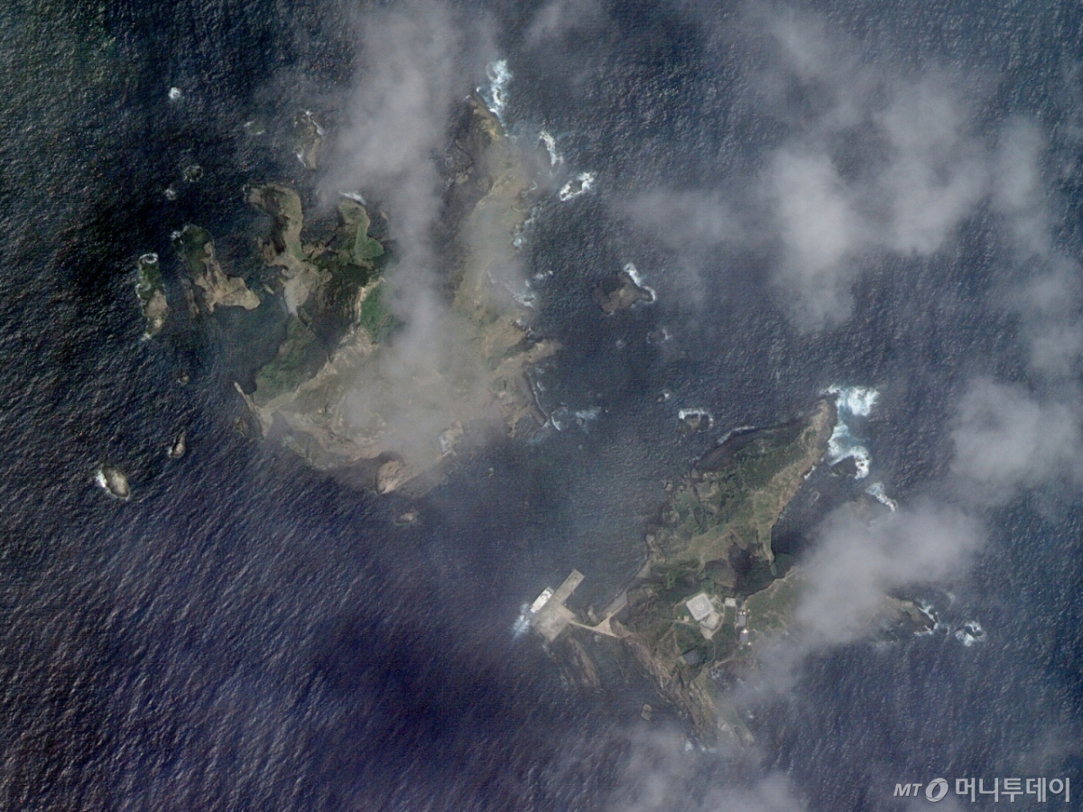
The "Eyes in the Sky," which fly over the Korean Peninsula approximately every three days to monitor the nation's territory, will begin their full-scale mission in December after completing initial operations.
On the 1st, the Aerospace Research and Development Institute, Ministry of Land, Infrastructure and Transport, Rural Development Administration, and Korea Forest Service released the initial operational results of Next-Generation Medium Satellite 2 (Territorial Satellite 2) and Next-Generation Medium Satellite 4 (Agriculture and Forestry Satellite).
Territorial Satellite 2, launched on May 3, is a territorial management satellite operated by the Ministry of Land, Infrastructure and Transport and the National Geographic Information Institute. As a "twin satellite" to Territorial Satellite 1, which was launched in 2021, it provides high-resolution imagery of the entire Korean Peninsula and overseas regions. The satellite's resolution is 0.5 meters for black-and-white images and 2.0 meters for color images. This level of detail allows for the identification of the type of vehicles parked on the ground when viewed from space.
Yang Hyo-jin, a researcher at the National Geographic Information Institute's Territorial Satellite Center, said, "Since the launch of Satellite 2, operating Satellites 1 and 2 simultaneously has allowed us to pass over the Korean Peninsula every 2.3 days, compared to every 4.3 days previously. The waiting time for recapturing specific areas has been reduced by half." Satellites 1 and 2 orbit with a phase angle interval of approximately 65 degrees.
The satellites' eyes reach areas that are difficult to access by drone or aircraft, such as North Korea, border regions with our country, and certain overseas locations. This enables the accumulation of data by capturing even areas where aerial photography is impossible with much greater precision. During its initial operational period, Territorial Satellite 2 successfully captured images of domestic locations including Dokdo and Seoul World Cup Stadium, as well as Niagara Falls in the United States and Starlake City in Hanoi, Vietnam.
The Agriculture and Forestry Satellite, launched on July 7, is an agricultural sector satellite operated by the Rural Development Administration and the Korea Forest Service. The satellite's swath width is a massive 120 kilometers or more, and it captures images daily. It covers 86% of the Korean Peninsula's area every three days. It can capture the entire Korean Peninsula at least 100 times in one year. It is equipped with five spectral bands, including visible light (blue, green, red), red edge, and near-infrared, to analyze the characteristics of vegetation, water, and soil.
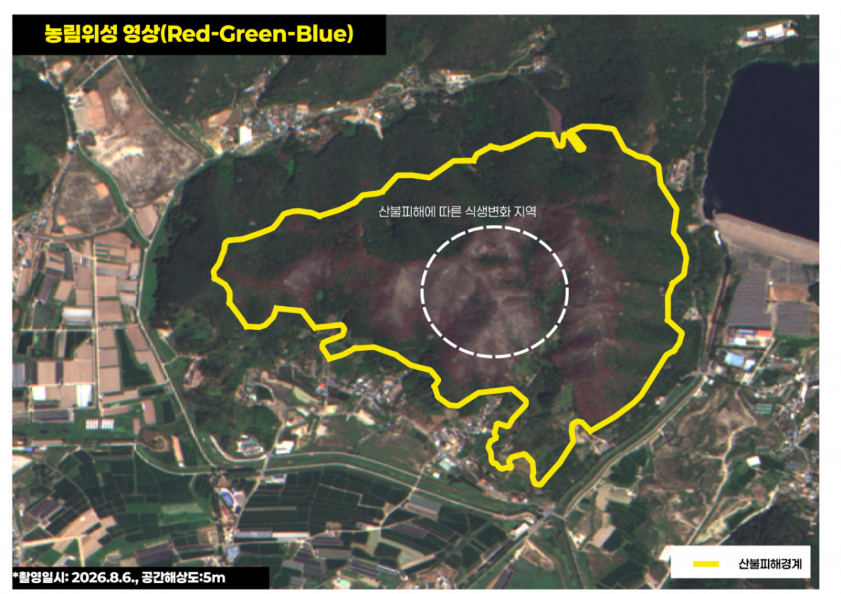
As wildfires become more frequent due to climate change, the role of the Agriculture and Forestry Satellite is expanding. This is because satellite data can be used to analyze damage boundaries, burned area quantities, and greenhouse gas emissions resulting from wildfires.
In fact, the Agriculture and Forestry Satellite was deployed during the major wildfire in Miryang, South Gyeongsang Province, last February. Park Chan-yeol, head of the National Forest Satellite Information Utilization Center at the Korea Forest Service, stated, "We demonstrated a higher resolution compared to overseas satellites (Sentinel)," adding, "It was possible to precisely distinguish the extent of vegetation damage in wildfire-affected areas and the degree of restoration after reforestation."
Analysis time has also been improved. It previously took approximately 13 hours to determine the exact scale of damage after a wildfire occurred, but this has been shortened to within about 9 hours. In the initial operational phase, domestic satellites such as the Cheonan satellite are used to identify fire points, while the Agriculture and Forestry Satellite performs precise analysis. Center Head Park said, "We are building an integrated platform capable of monitoring through the restoration process."
The development and manufacturing of Territorial Satellite 2 and the Agriculture and Forestry Satellite were handled by KAI (Korea Aerospace Industries). Jang Jong-jin, a division head at KAI, stated, "By leading the development of Next-Generation Medium Satellites 3, 4, and 5, we have built autonomous system integration technology," adding, "We will continue to strive for the domestic production of satellite components and the activation of the space industry ecosystem."
The two satellites will complete their initial operations by the end of this year. They will then be transferred to the Aerospace Research and Development Institute's National Satellite Operations Center to begin their full-scale mission.

 in TECH

